In Europe, this drive for open and free marine knowledge has led to the European Commission funding the European Marine Observation and Data Network (EMODnet) as a long-term initiative to unlock Europe’s marine data spanning seven thematic portals: Bathymetry, Geology, Physics, Chemistry, Biology, Seabed Habitats and Human Activities. EMODnet’s online web services provide unrivalled access to a wealth of marine data and data products, which can assist marine and maritime stakeholders in using marine knowledge for their own activities and applications.
Seascape Belgium is a marine and maritime consultancy that coordinates the EMODnet Secretariat and is a contributing partner to ATLAS Work Package 8 - Open Science Resources for Stakeholders. Seascape Belgium are facilitating the entry of ATLAS data into EMODnet and are also developing geo-spatial visualization tools to enrich the ATLAS marine knowledge value chain. Through this work, ATLAS data will be more user-friendly for wider stakeholders, including those in industry, ocean governance and management.
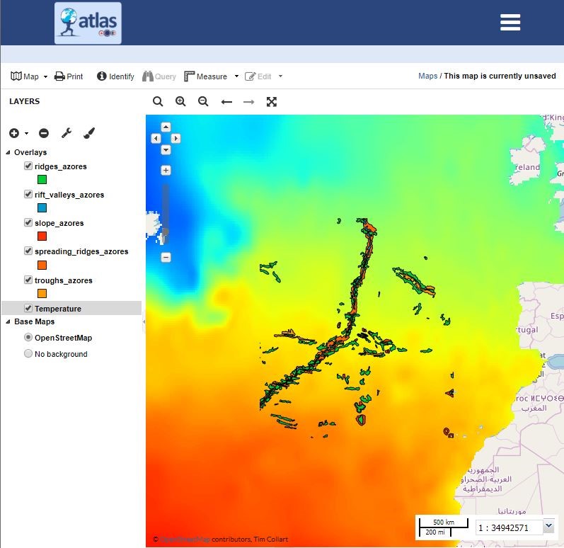
Specifically, Seascape Belgium is using an open source geospatial content management system –GeoNode – to develop an online platform that focuses on users and facilitates collaborative use of geospatial data and maps. The GeoNode is designed around the 12 ATLAS project case studies. It provides an online platform for enhanced exchange of information amongst ATLAS partners on data produced across the project, and it facilitates project development of area-based management plans (Work Package 6).
The ATLAS GeoNode is embedded in an Atlantic ATLAS community page, hosted on the EMODnet central portal. This promotes the ATLAS project to a wide range and number of stakeholders already visiting the EMODnet web services. It also ensures the long-term visibility and impact of ATLAS data beyond the duration of the project. This is vital to raise awareness among the marine and maritime community on the wealth of data and products produced by ATLAS and to make them FAIR. It also promotes the use of ATLAS data for a range of applications in marine management and conservation.
Another benefit of the GeoNode is that users can create their own customised maps based on ATLAS data as well as other open source data from the region of interest through remote web services (e.g. EMODnet). Focused on visualization of ATLAS and wider data, the GeoNode also links directly back to the ATLAS website for interested stakeholders to discover more about the ATLAS project.
Discover more about Seascape Belgium’s contribution to ATLAS in the presentation from the 4th ATLAS General Assembly here: https://bit.ly/2JxsVIz or check out the ATLAS GeoNode here: atlas-horizon2020.eu
By: Kate Larkin, Tim Collart & Pascal Derycke (Seascape Belgium)


